

REVEALED: Map shows detailed location of Louth's 778 confirmed Covid-19 cases


Details on where confirmed Covid-19 cases are located in Louth are published in a new publicly accessible database on the pandemic outbreak in Ireland.
The updated Covid-19 dashboard shows figures by electoral districts. At present, Louth has not seen a new recorded case of the virus in nine days.
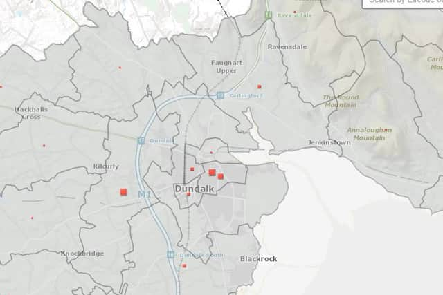
CLICK ON THE IMAGE ABOVE TO ACCESS THE MAP DATABASE and scroll down to section entitled "COVID-19 Confirmed Cases at Electoral Division (ED) Level"
The figure for the greater Dundalk area is approximately 195 in total; broke down as follows: Castletown 59, Dundalk No 1 Urban 8; Dundalk No 2 Urban 5; Dundalk No 3 Urban 6; Dundalk Number 4 Urban 27; Dundalk Rural 65; Haggardstown 18 and Ballymascanlon 7
For confidentiality reasons, exact figures are not published when there are less than five infections in an area.
The map also shows the Dromiskin area had 12 confirmed cases, Darver 7, Mansfieldtown 6 and Castlebellingham 6. Drumcar saw a spike with 19 cases from a population of 1447. Dunleer also saw 19 cases from a population of 2855.
Further down the county, Clogherhead saw 25 cases from a population of 3,237. Termonfeckin had the highest rate with 90 confirmed cases form a population of 3,545. Which, if tabulated for a bigger scale, would have seen a rate of 2,538 cases per 100,000 population.
Collon, bordering Co. Meath, reported 11 cases from it’s 1881 listed population.
In the greater Drogheda area, one of the large clusters of cases occurred in the Fair Gate electoral district, with 86 confirmed cases from a population of 10,424. Meanwhile, St Peter’s saw just 22 cases from a similar population size (9721).
West Gate with a population of 6305 had 43 cases of the virus, while St Mary’s currently has 27 cases of Covid-19.
St Lawrence Gate had a noticeable spike with 61 cases from a smaller population size of 4068.
As of June 18, there have been 778 cases of Covid-19 in Louth since February 29.
Dr Ronan Glynn, Deputy Chief Medical Officer, Department of Health, said the new Covid-19 dashboard was launched on Thursday, June 18 to provide up-to-date information on the key indicators of Covid-19 in the community, including the number of daily cases, deaths, number of people in hospital and ICU and a daily update on testing figures.
He added that it would help communities to be aware of the disease.
“In addition, the dashboard also allows people to monitor the number of cases of Covid-19 in their local area. The management of Covid-19 is an individual task, where we all must remain aware of the disease in our community, follow public health advice and adopt protective behaviours,” he said.
The dashboard is a collaboration between the Department of Health, Ordnance Survey Ireland, the All-Island Research Observatory, HPSC, HSE, and the Central Statistics Office (CSO).
There have been 25,355 confirmed infections and 1,714 deaths in Ireland during the pandemic.