

LOUTH WEATHER: 'Remnants' of Hurricane Dorian could pass close by

Forecast
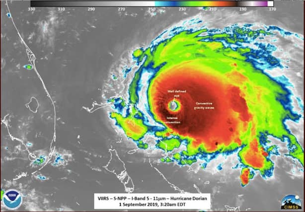
According to local weather expert Louth Weather, there's a chance that the deadly category 5 Hurricane, Hurricane Dorian could pass close by the area next week.
In a Facebook update today, Louth Weather explained what could happen next week
"The remnants of Hurricane Dorian may pass close by early in the week, but it will be well-weakened by then.
"Early this week we see high pressure south of Ireland. Later in the week another high (currently over the USA) will be positioned out west of Ireland. So high pressure is the dominant influence on our weather, but they will be quite far away, allowing more unsettled conditions at times."
Louth Weather also gave a daily forecast for this week:
MONDAY - A cloudy day. Dry this morning. Some light patchy rain likely at some stage during the afternoon. Drier again towards evening. Moderate westerly winds. Max 17°C.
TUESDAY - Cloudy. Dry during the morning. Light rain on and off during the afternoon, with some heavier rain possible before teatime. Moderate SW winds. Max 19°C.
WEDNESDAY - Some decent sunny breaks. Good dry periods but a spell of heavy rain likely late morning. Fresh NW winds, with some stronger gusts possible. Max 16°C.
THURSDAY - Mostly cloudy but dry. Fresh NW winds. Max 16°C.
FRIDAY - Mostly cloudy. Good dry periods but some light rain possible. Fresh NW winds. Max 17°C.
THE WEEKEND - Early indications suggest mostly cloudy but dry conditions. Winds easing, NW to begin, SE later. Temperatures around average for the time of year.