

LATEST: Met Eireann may issue Orange Weather Warning for Lorenzo

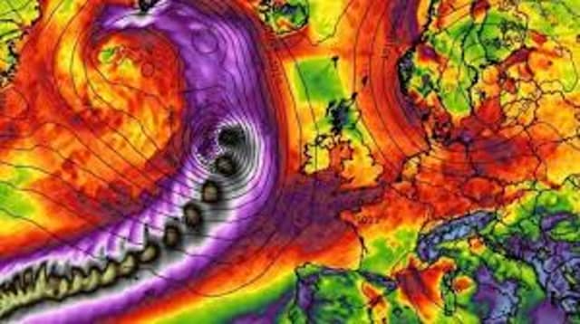

Lorenzo
UPDATED 4pm: Lorenzo has increased in strength from a Category 2 to Category 3. Sea Surface Temperatures are still up at 25°C and wind shear is low (less than 15mph), which are good for storm development
Of interest to us is the latest GFS run which has changed again and now shows Lorenzo right over us at 8am Friday.
Met Eireann is expected is issue a Weather Warning tomorrow morning in advance of Hurricane Lorenzo which is expected to make impact a day later.
An initial Status Orange level weather warning is most likely as it warns people to prepare for adverse conditions.
The National Hurricane Centre in the US is closely tracking Lorenzo and said today that it currently has wind speeds of 100 miles per hour or 161 km per hour in the south Atlantic Ocean and is moving faster north eastwards towards Western Europe.
Lorenzo is being compared to Storm Ophelia which hit Ireland almost two years ago and was regarded as the most powerful to hit Ireland in half a century.
On that occasion, Met Eireann issued a Status Orange Alert before upgrading it to an extremely rare Status Red Weather Alert - which resulted in all schools and many workplaces shutting.
Ophelia brought wind speeds of 156 km per hour, caused 360,000 power cuts to customers, lifted roofs, knocked trees and caused significant coastal flooding.
Tragically three lives were lost - two were killed when trees fell on their cars and another man died while clearing a fallen tree with a chainsaw.
Kildare Co Council and other local authorities have been contacted by Environment Minister Eoghan Murphy and asked to prepare for storm impacts by activating Crisis Management and Local Co-ordination arrangements.
The National Directorate for Fire and Emergency Management is meeting this morning.
In its latest update, Met Eireann said: "There is still uncertainty regarding the exact of Lorenzo, there it a high probability that it could track close to or over Ireland in a weakened form, bringing strong winds, southeasterly initially, veering westerly and strengthening further, with a risk of severe winds developing later Thursday and Thursday night, depending on the track.
"Spells of rain also, with high seas and swells."
Irish Weather Online experts said that Lorenzo will weaken as it reaches Ireland and a Yellow Alert is most likely.
The added: "The most likely outcome would be south to southwest winds of 60 to 100 km/hr in many parts of the country, and 80 to 120 km/hr near exposed western and later northern coasts."